

Integrated Document Technologies
ESRI | GIS Management
Enhance Your GIS Investment
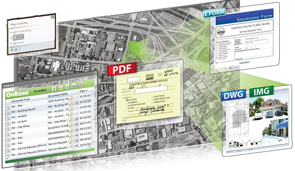
Maximize the benefits of your geographic information system (GIS) with the GIS management solutions from IDT. GIS is missing key aspects of the daily business of government – documents, content and processes. With the GIS integration functions from OnBase™ and CAPSYS CAPTURE™, you can easily link documents, drawings, and processes directly to your map software, streamlining the process. Team IDT helps you make the most of your existing programs to help your staff make decisions and process documents even faster. Our Esri integrations work with leading Land Management and Permitting applications from software firms such as Harris Govern, Accela, Cityworks and more.
Better Together! Find out how
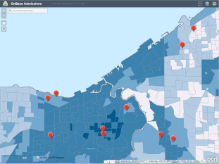
Horry County connected their OnBase and Esri together to map its innovative County GIS service solutions!
Download our GIS Integration solution brief by clicking here!
Click here to read how the next evolution for GIS professionals is connecting their GIS system to other solutions.

Fully Integrated
Quickly respond to requests and share information through your Esri™ GIS program. OnBase™ and CAPSYS CAPTURE™ gives GIS users the power to attach related information directly to points on a map, so your staff can process documents without ever leaving their familiar GIS environment. Content is just a mouse-click away.
Sharing Made Easy
Whether staff is in the office or in the field, using separate photos, maps, and documents to share information slows down the process. Projects often take longer because information is scattered across filing cabinets and disparate systems, causing delays in getting documents to those who need them. Likewise, the review process is slowed down by the fact that only one person can review a paper file at a time.
With OnBase™ and CAPSYS CAPTURE™ Integration for Esri™, processes no longer stop while GIS users search for related documents. All of the necessary information, including permits, licenses, and other important files, are accessible directly from the maps they use every day. Suddenly, every member of your staff has access to the documents they need right when they need them.
Up to Date
At IDT, we understand how important it is for our technology to stay relevant and useful on a day-to-day basis. OnBase™ and CAPSYS CAPTURE™ keep pace with Esri's™ current product improvements and supports the latest GIS technology with ArcGIS Silverlight Viewer and Silverlight API-based applications. We also offer web services to support integration with ArcGIS Flex and JavaScript API-based applications.
Enhanced Functions
- Securely Stores Information
- Automates Processes to Speed up Reviews
- Provides Easy Information Access
- Improves Business Process
- Saves Time & Money
- Provides Instant Access
- Speeds up Processes
- Reduces Employee Training